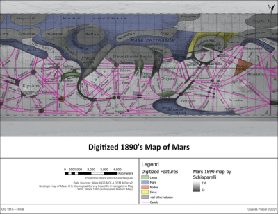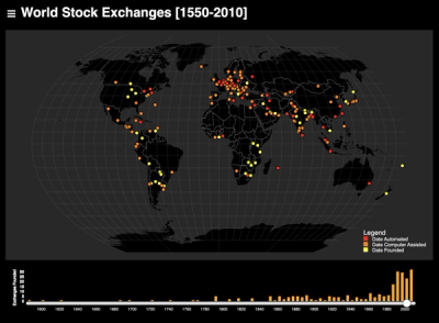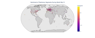
Data Visualizations
My digital humanities research focuses on integrating natural language processing techniques with geographic information systems to facilitate a critical dialogue between data science, information studies, and geography. These data visualization projects employ data science nad mapping techniques to uncover patterns within textual data and visual records using named entity recognition, data visualization, machine learning, GPT-based classification, and georectification of historical maps. In the projects listed below, I strive to combine computational methods for processing historical materials with visualization and mapping techniques. While some of these projects were exploratory and experimental, they exhibit the skills and techniques applicable to future research.